Sectional Charts & Weather (Part 107)
Airspace classes, sectional-chart conventions, and the weather briefing every remote PIC is required to do before flight.
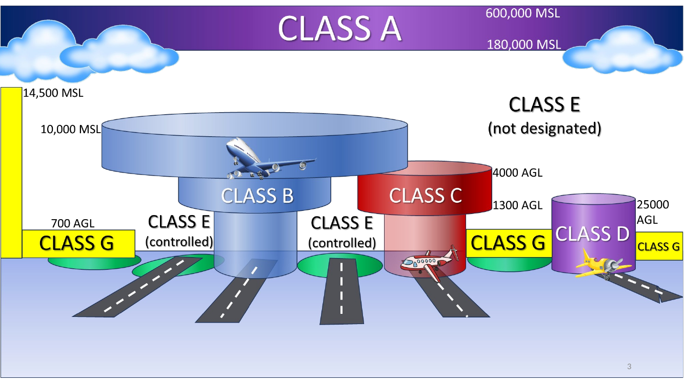
Quick-reference: airspace classes
| Class | Floor → Ceiling | Sectional line | sUAS authorization? |
|---|---|---|---|
| A | FL 180 – FL 600 MSL | n/a (IFR only) | n/a |
| B | SFC – 10 000 MSL | Solid blue | Yes (LAANC) |
| C | SFC – 4 000 AGL | Solid magenta | Yes (LAANC) |
| D | SFC – 2 500 AGL | Blue dashed | Yes (LAANC) |
| E (surface) | SFC up | Magenta dashed | Yes |
| E (700 AGL) | 700 AGL up | Shaded magenta | No (below 400 AGL) |
| E (1 200 AGL) | 1 200 AGL up | Shaded blue | No |
| G | SFC – 700 or 1 200 AGL (wherever not overlaid) | Unmarked | No |
Weather / Reading sectional charts — title
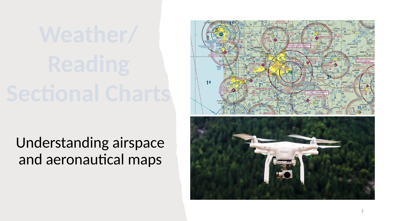
Deck scope — what UAS (drone) pilots need before flight.
- Airspace classes (A, B, C, D, E, G) and how to recognize them on a sectional chart.
- Sectional chart conventions — line colors, ceiling notation (MSL vs AGL), the “add 00” rule.
- Weather — reading a METAR and using temperature/dewpoint to estimate cloud base.
- Part 107 operating limits — where you need ATC authorization, how far from clouds, etc.
UAS operators must obtain prior authorization in controlled airspace
The headline rule. Under 14 CFR Part 107, UAS operators are required to obtain prior authorization before operating in any controlled airspace (Classes B, C, D, and the surface-area portions of Class E around airports).
- Exception — non-surface Class E airspace (the far-from-airports kind).
- How to get authorization — FAA’s LAANC (Low Altitude Authorization and Notification Capability) system, typically via apps like Aloft or Airmap. Some airports still require a manual DroneZone request.
Sectional chart cover illustration
Cover illustration for the Sectional Aeronautical Chart reference. The chart is the pilot’s standard map for US airspace — typically at a 1:500 000 scale — and encodes airspace class, terrain elevation, obstructions, airports, radio frequencies, and visual landmarks.
Relevant acronyms — AGL and MSL
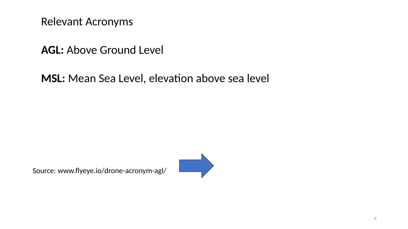
Altitude reference frames — memorize both.
- AGL — Above Ground Level. Height above the terrain directly below. Used for Part 107’s 400 ft ceiling and most airspace ceilings of Class C, D, E (700/1200 AGL).
-
MSL — Mean Sea Level. Absolute elevation above the ocean. Used for Class A (FL 180 MSL – FL 600 MSL) and many sectional-chart ceiling callouts.
- Pilot trap: the same “100 ft” means very different things depending on which frame. If a sectional ceiling says “70” without parentheses, it’s MSL (add 00 → 7 000 ft MSL). If it’s in parentheses like “(12)” it’s AGL.
Class A airspace (FL 180 – FL 600 MSL)
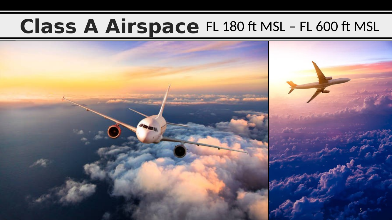
Class A airspace.
- Floor: Flight Level 180 (18 000 ft MSL).
- Ceiling: FL 600 (60 000 ft MSL).
- Who uses it: airliners and military. All operations are IFR only.
- Not a drone concern — a sUAS under Part 107 is capped at 400 ft AGL, nowhere near Class A.
Sectional Aeronautical Chart legend
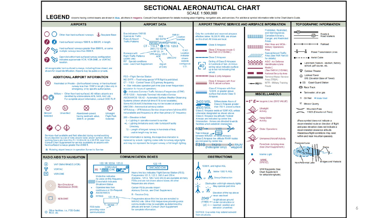
Sectional chart legend. Every sectional chart has a legend that decodes the symbology: airport markers, airspace boundaries (blue / magenta, solid / dashed), obstructions, communication frequencies, topographic relief, miscellaneous.
- On the exam — know the four airspace-boundary conventions: solid blue = Class B, solid magenta = Class C, dashed blue = Class D, dashed magenta = Class E surface area.
Sectional Aeronautical Chart legend (continued)
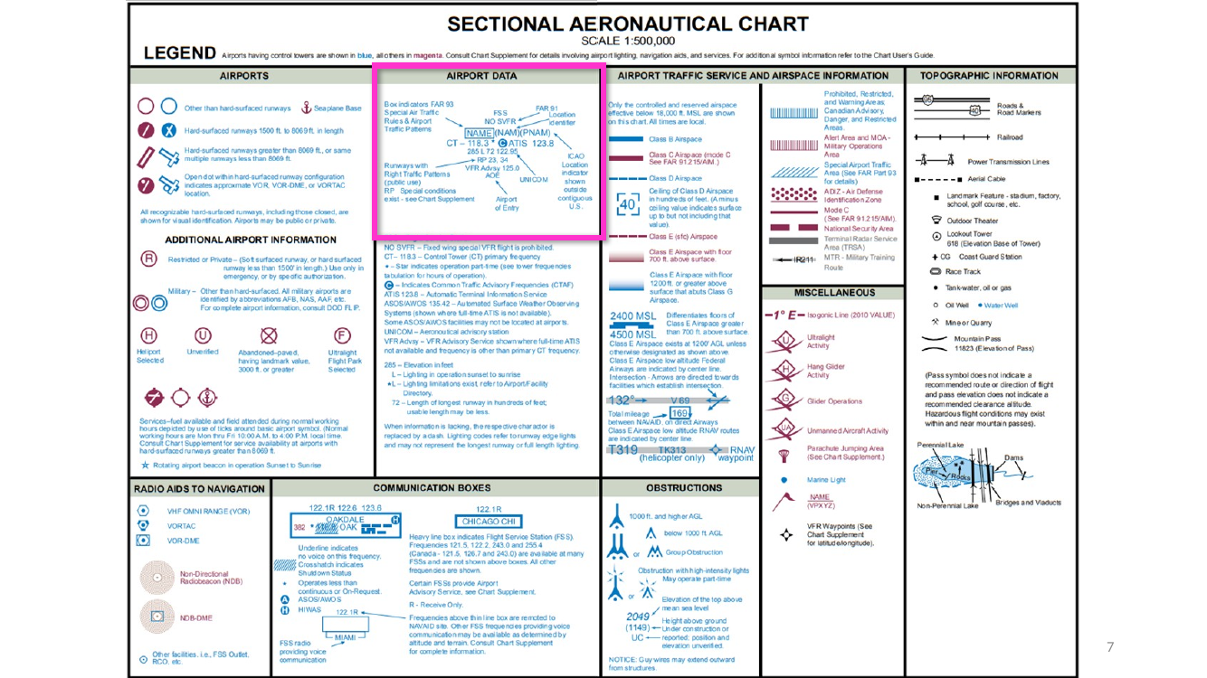
Same sectional legend repeated — emphasizing how much info is packed onto every chart. Spend time with the legend before ever planning a flight; recognizing the symbology is a Part 107 exam staple.
Airport advisory + weather acronyms — CTAF, ATIS, AWOS, ASOS
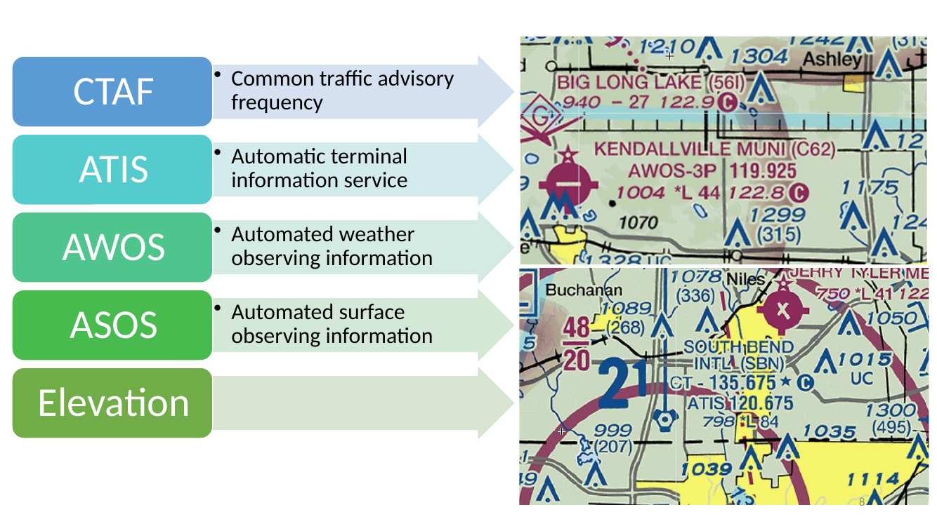
Airport advisory / weather acronyms — decode them on sight.
- CTAF — Common Traffic Advisory Frequency. Pilots self-announce on this at uncontrolled fields.
- ATIS — Automatic Terminal Information Service. Recorded broadcast of current weather and operational info at towered airports.
- AWOS — Automated Weather Observing System. Continuous, automated weather broadcast (FAA-operated).
- ASOS — Automated Surface Observing System. Continuous, automated weather broadcast (NWS-operated; more sensors).
- The little “Elevation” label calls out where an airport’s field elevation is printed on the sectional (immediately after the airport name).
Sectional Aeronautical Chart legend (reference)
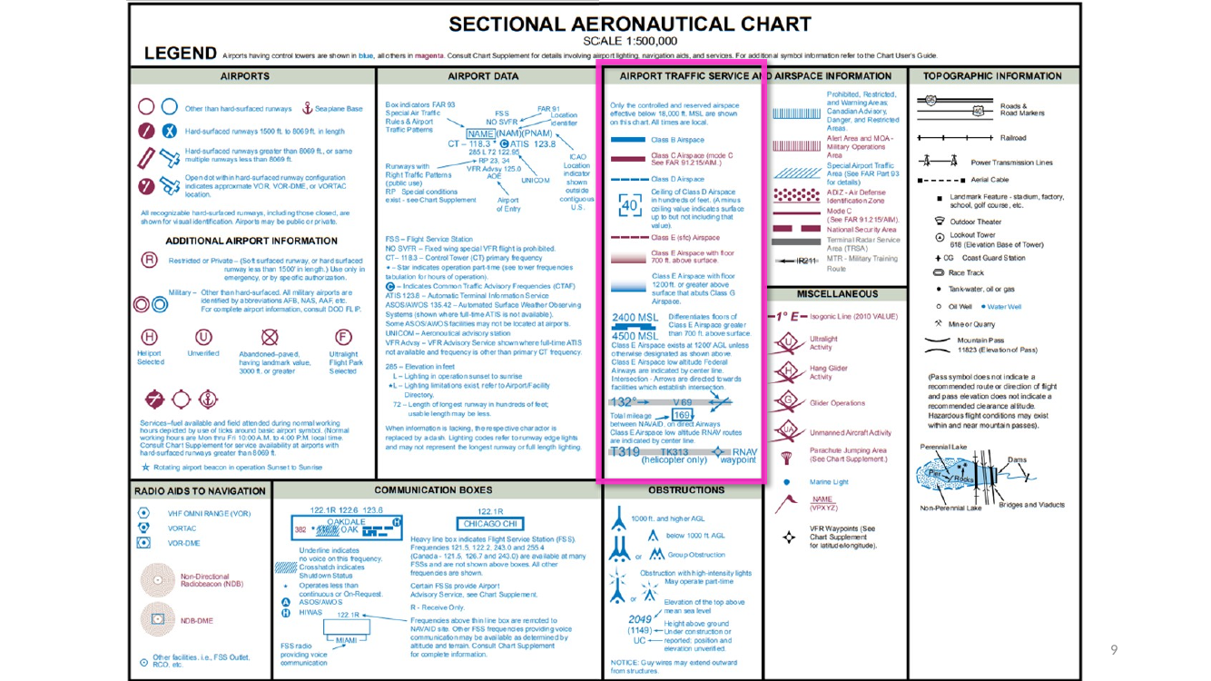
Legend reference (third copy). The legend is repeated intentionally — the instructor wants you to internalize it. If you can’t recognize the symbol without looking, keep studying.
Class B airspace (SFC – 10 000 MSL) — “B = Big, B = Busy”
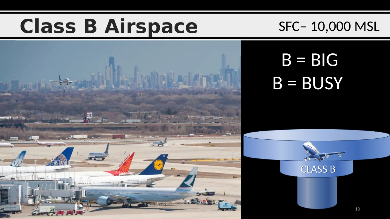
Class B airspace (“Big / Busy”).
- Floor: surface (SFC).
- Ceiling: typically 10 000 ft MSL.
- Shape: inverted wedding cake — progressive tiers expanding upward and outward from the busiest airports (ATL, LAX, ORD, JFK, SFO, BOS, etc.).
- Sectional marking: solid blue lines.
- Drone rule: always needs ATC authorization (Part 107.41 / LAANC).
Solid blue lines on a sectional = Class B
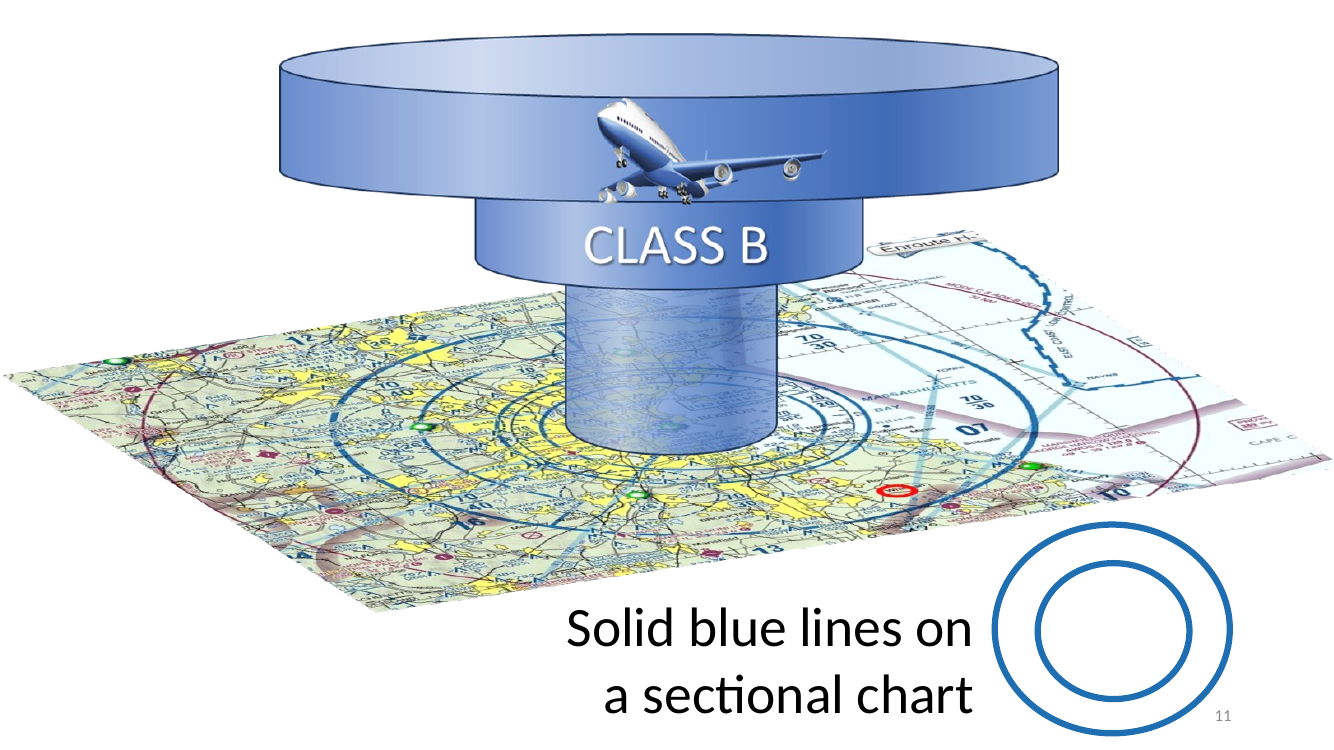
Sectional cue — solid blue lines = Class B. Everything enclosed within a continuous blue boundary is Class B. The ceiling/floor for each ring of the “wedding cake” is printed as a stacked fraction (see slides 12–13).
Logan International Airport, Boston (KBOS)
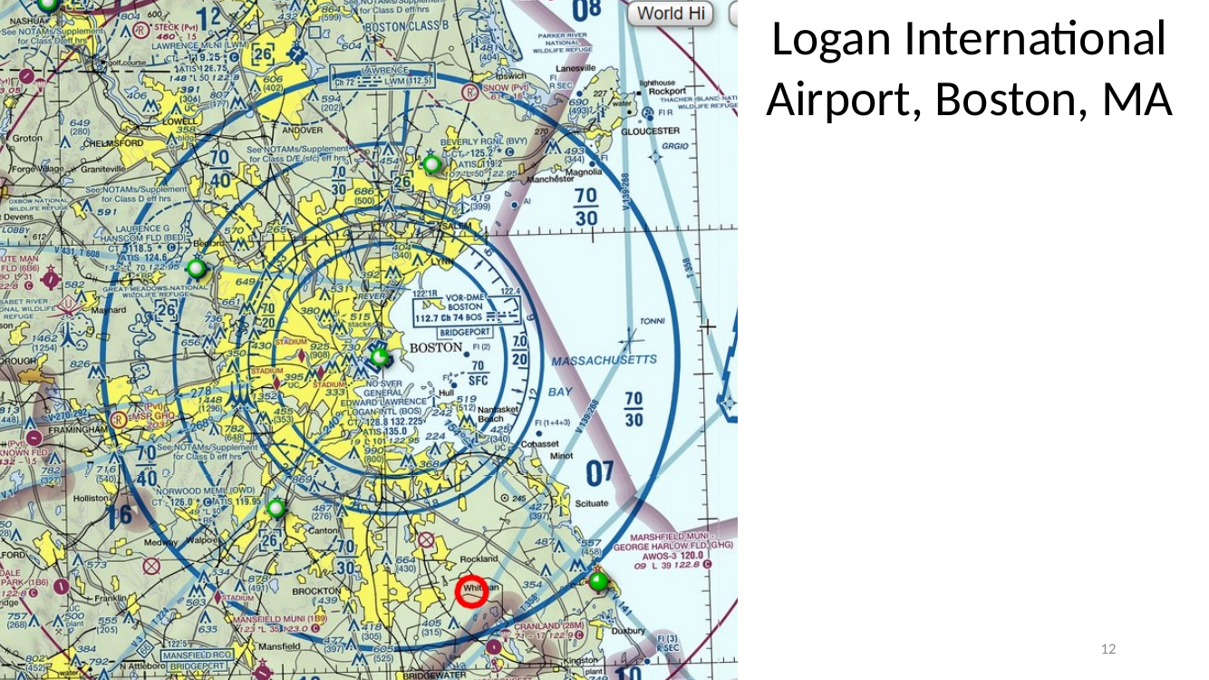
Logan International Airport, Boston (KBOS). Classic Class B example surrounded by solid blue rings on the sectional.
- Downtown Boston is inside the innermost ring (SFC – 7 000 MSL).
- Outer rings extend progressively upward in altitude bands.
Reading Logan’s Class B ceiling — the fraction and the rules
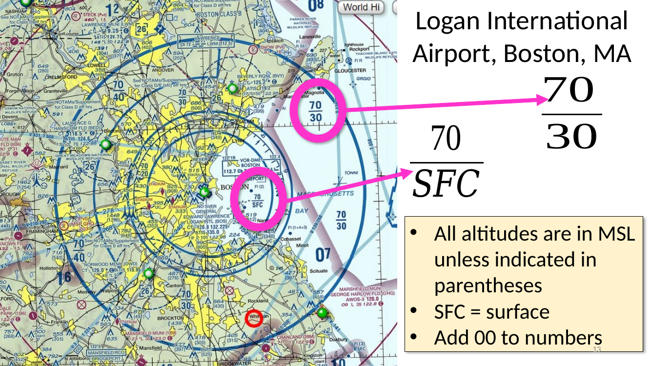
Reading Logan’s Class B ceilings.
- The fraction 70 / 30 means ceiling 7 000 MSL, floor 3 000 MSL (add two zeros to each number).
- The fraction 70 / SFC means ceiling 7 000 MSL, floor is the surface.
- All altitudes are in MSL unless in parentheses — if you see “(12)”, that’s 1 200 ft AGL.
San Francisco International — authorization question
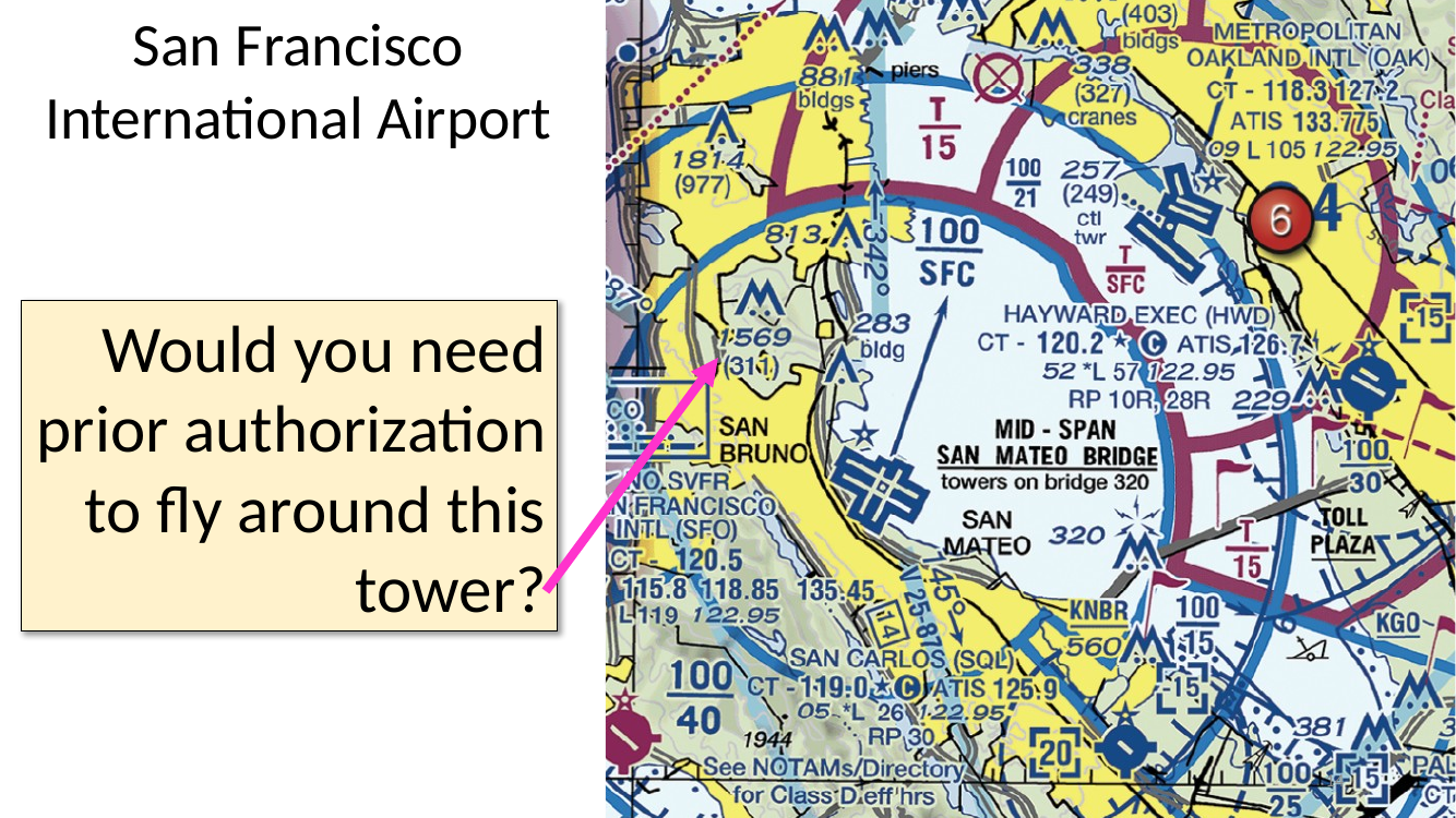
San Francisco International (KSFO) — a question to answer. “Would you need prior authorization to fly around this tower?”
- Yes. KSFO sits inside Class B airspace (solid blue). Under Part 107, any flight inside B/C/D or surface-area E requires ATC authorization via LAANC.
Class C airspace (SFC – 4 000 AGL) — two-ring structure
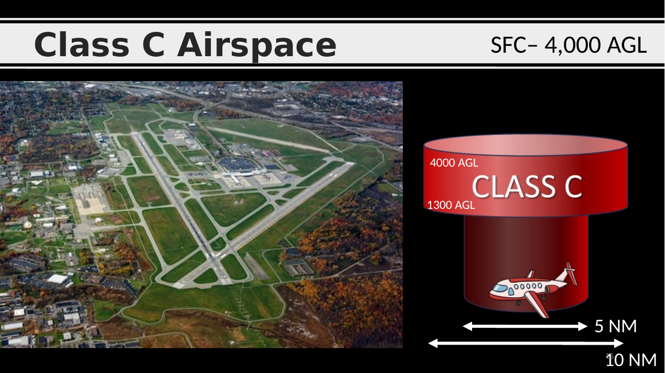
Class C airspace.
- Floor: surface at the core.
- Ceiling: typically 4 000 ft AGL.
- Shape: two-ring “layer cake”:
- Inner ring: 5 NM radius, SFC – 4 000 AGL.
- Outer ring (“shelf”): 10 NM radius, from ~1 200 AGL up to 4 000 AGL.
- Often extends a further 20 NM radio outer area (not shown).
- Sectional marking: solid magenta lines.
- Drone rule: ATC authorization required.
Class C airspace — overview
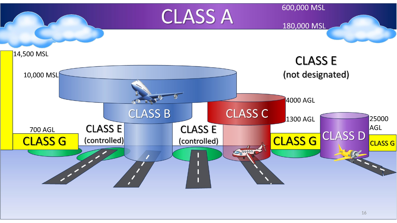
Class C overview diagram. Review the two-ring (inner 5 NM / outer 10 NM) structure — the 1 200 ft AGL shelf on the outer ring is the detail the exam loves to ask about.
Solid magenta lines on a sectional = Class C
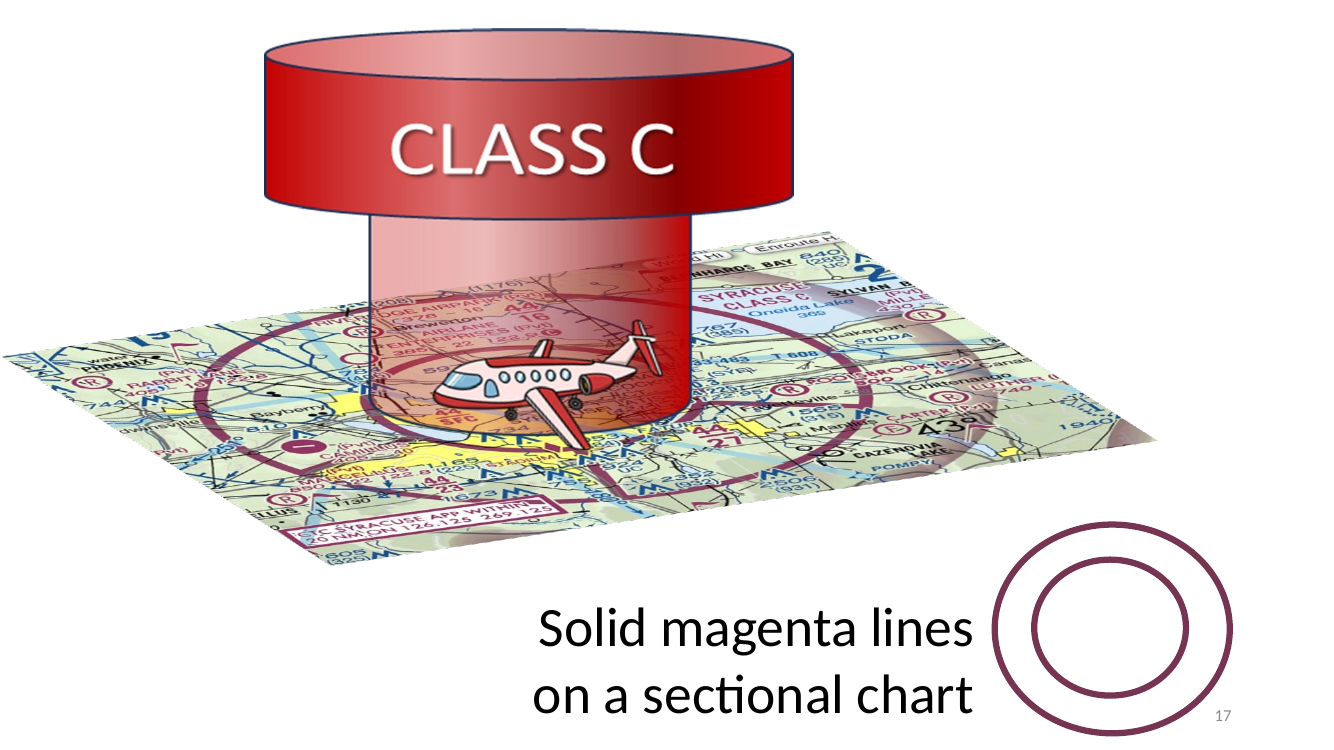
Sectional cue — solid magenta lines = Class C. Recognize on sight. The magenta fraction stack gives the ceiling/floor (same “add 00” rule as Class B).
Syracuse Hancock International — Class C example
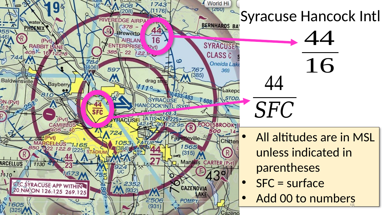
Syracuse Hancock International (KSYR). Classic Class C example.
- 44 / 16 outer ring → ceiling 4 400 MSL, floor 1 600 MSL (add 00).
- 44 / SFC inner ring → ceiling 4 400 MSL, surface up.
- Airport field elevation ≈ 421 ft MSL, so 4 400 MSL is roughly 4 000 ft AGL — matches the standard Class C ceiling rule.
Class D airspace (SFC – 2 500 AGL)
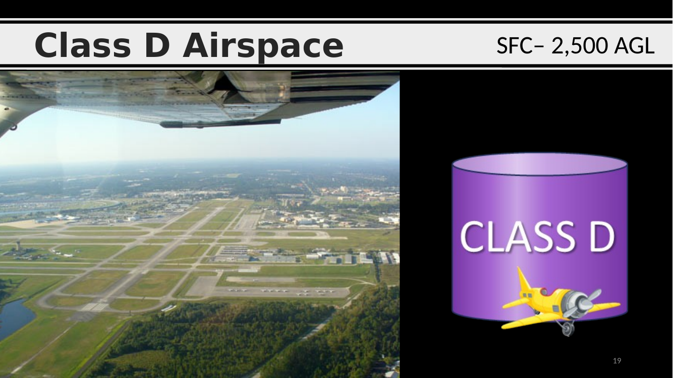
Class D airspace.
- Floor: surface.
- Ceiling: typically 2 500 ft AGL.
- Shape: a single cylinder, usually 4–5 NM radius.
- Sectional marking: blue dashed lines.
- Drone rule: ATC authorization required (LAANC).
Dubuque Regional, Iowa — Class D example
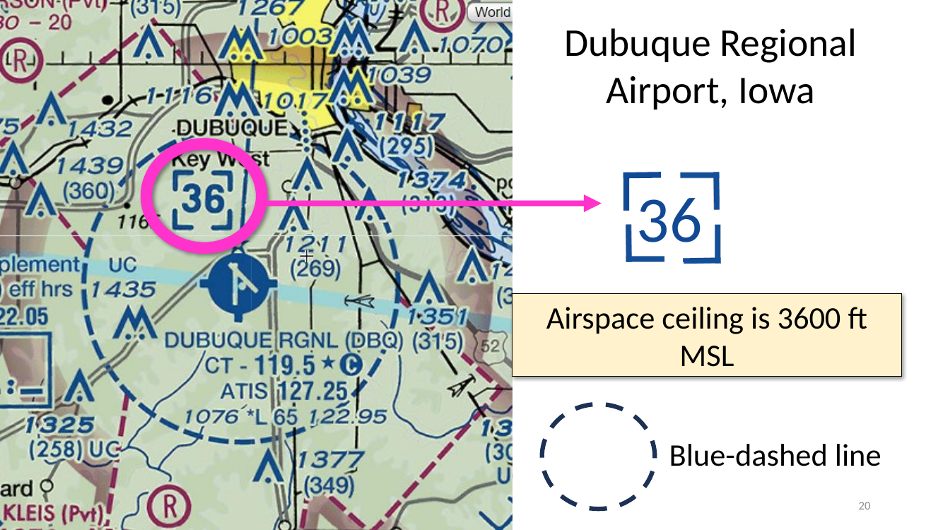
Dubuque Regional (KDBQ), Iowa — Class D example.
- The 36 printed inside the dashed blue boundary = 3 600 ft MSL ceiling (add 00).
- Floor = surface.
- Blue-dashed line = Class D. Memorize the line convention on sight.
Class E airspace — three common variants
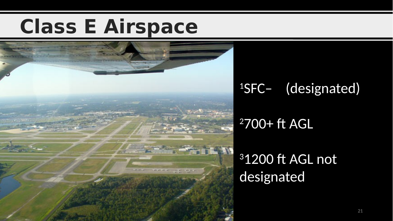
Class E airspace — three common variants. The “catch-all” controlled airspace.
- Surface designated (E surface) — SFC up, around certain airports. Dashed magenta boundary on the sectional. Requires ATC authorization for sUAS.
- 700+ ft AGL — shaded magenta area. Floors at 700 ft AGL. Drones under 400 ft AGL do not need authorization here.
- 1 200 ft AGL not designated (the “default” E) — shaded blue. Floors at 1 200 ft AGL; again, no sUAS authorization needed below 400 AGL.
Class E surrounding Class C airspace
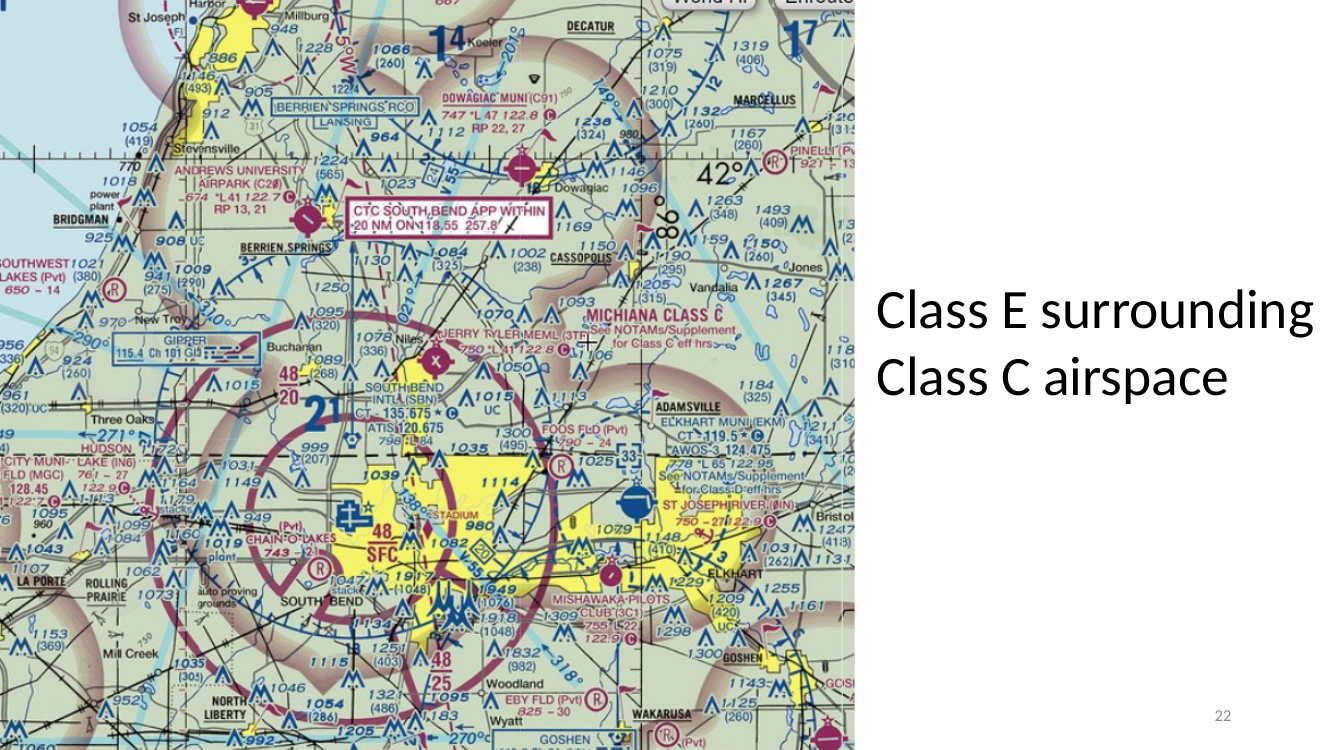
Class E surrounding Class C (or any other surface-area class). Many Class C/D airports have a ring of Class E surface-area airspace beyond the magenta/blue boundary — it extends the “surface-up” controlled airspace radius for approaching IFR traffic.
- Dashed magenta = Class E surface area (needs sUAS authorization).
Class G airspace — uncontrolled
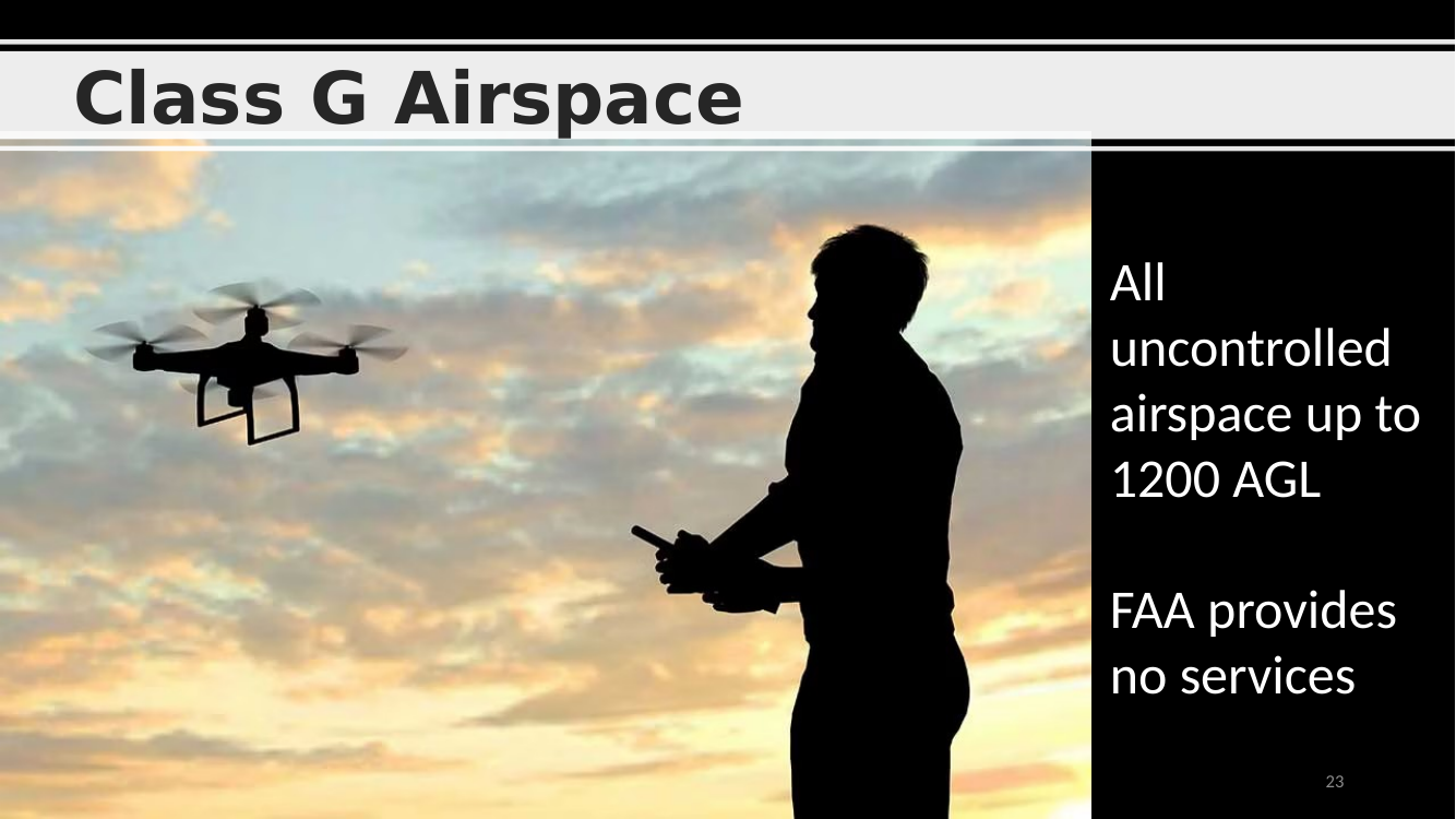
Class G airspace — “Uncontrolled.”
- Default airspace from the surface up to 700 or 1 200 ft AGL wherever there is no overlying B/C/D/E designation.
- The FAA provides no ATC services in Class G.
- Drone rule: no ATC authorization needed in Class G, but all other Part 107 rules still apply (400 AGL limit, visibility, cloud clearance, daylight, 100 mph, etc.).
Worked example — Class C ceiling math in MSL vs AGL
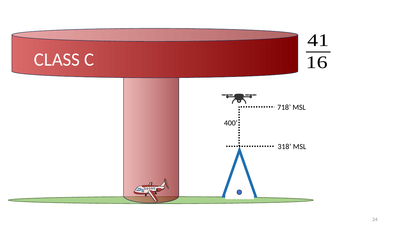
Worked example — Class C ceiling math.
- Sectional fraction 41 / 16 on a Class C ring → ceiling 4 100 MSL, floor 1 600 MSL.
- Airport field elevation labeled 318’ MSL on the chart.
- Callout 718’ MSL = 318 (ground) + 400’ AGL limit = max legal drone altitude MSL at that spot.
- Takeaway: Part 107’s 400 AGL cap becomes a site-specific MSL number once you know the terrain elevation. Plan in AGL, report in MSL.
Part 107 practice question — Class C authorization
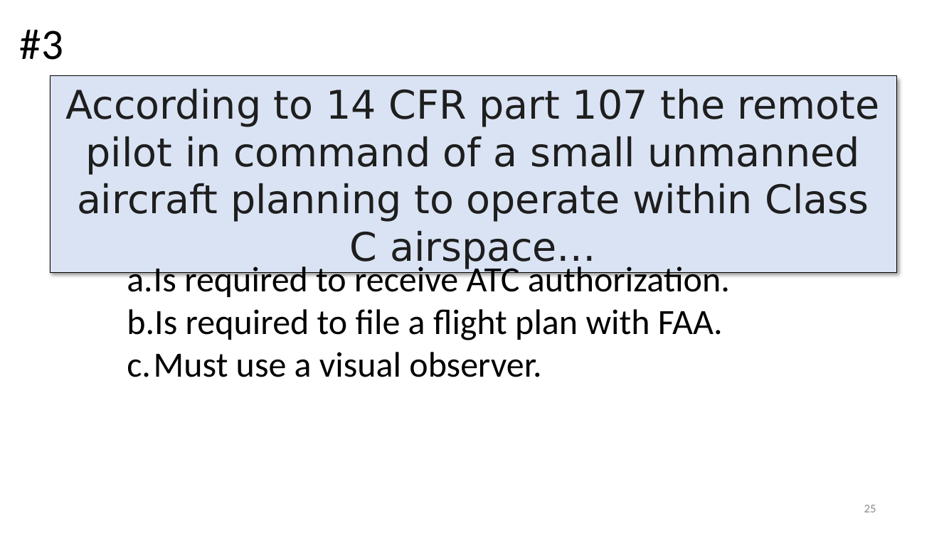
Practice question — 14 CFR Part 107 Class C.
“According to 14 CFR part 107 the remote pilot in command of a small unmanned aircraft planning to operate within Class C airspace…”
Answer: (a) Is required to receive ATC authorization.
- (b) is wrong — Part 107 flights do not file flight plans.
- (c) is wrong — visual observers are optional unless the RPIC can’t personally see the aircraft.
Non-designated Class E (floor at 700 ft AGL)
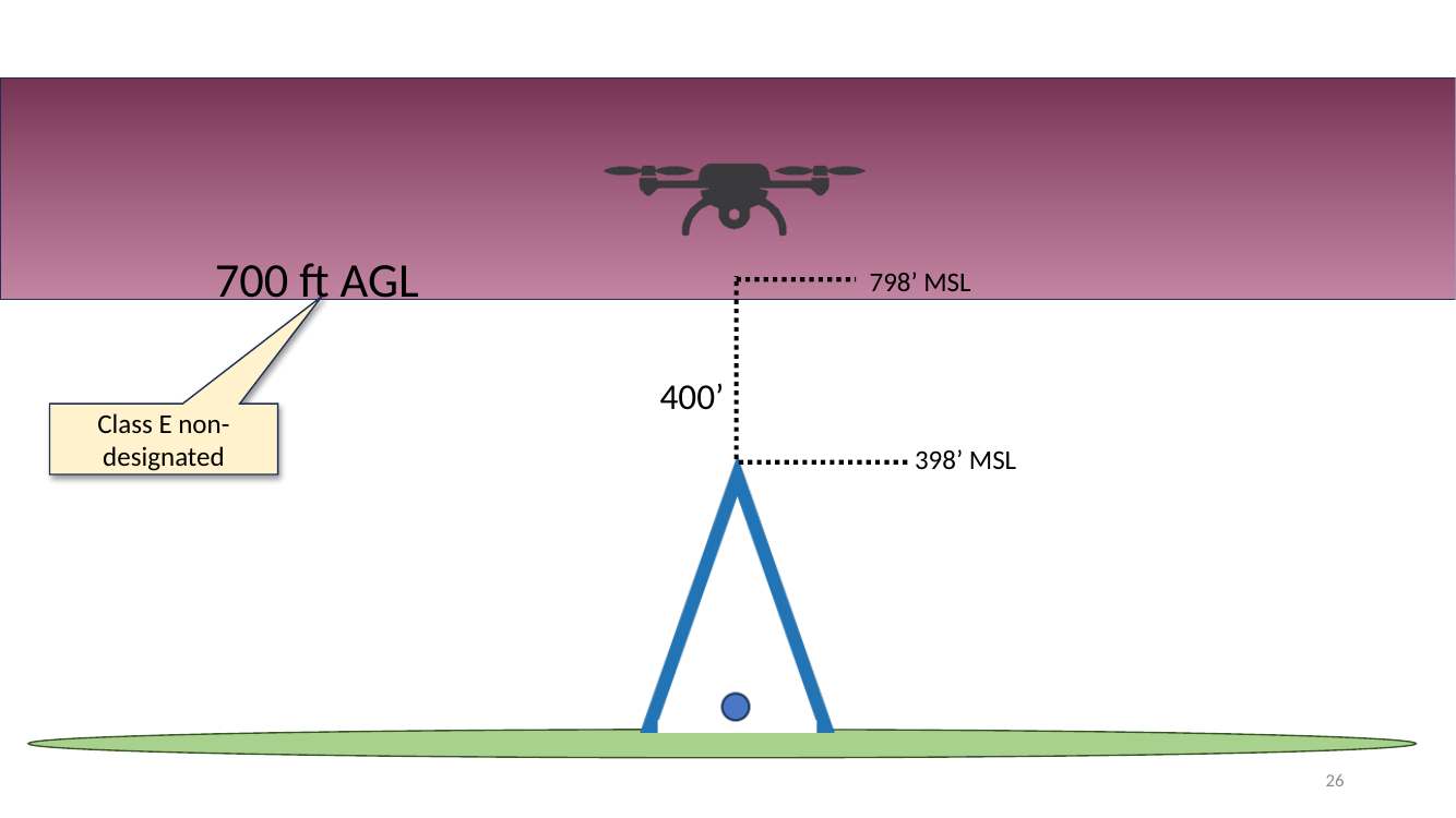
Non-designated Class E (floor at 700 ft AGL).
- The drone’s 400 ft AGL ceiling sits beneath the Class E floor → you’re in Class G (uncontrolled) from the ground up to 700 AGL.
- Example numbers: terrain 398’ MSL, drone at 400’ AGL = 798’ MSL — still below the 700 AGL Class E floor.
- Practical upshot: under shaded-magenta (non-designated) E, sUAS pilots almost never cross into Class E, so no authorization is needed.
Section — Weather and Flight
Section divider — Weather and Flight. Next slides cover the weather check a remote PIC is required to do before flight, plus decoding METARs and cloud-base estimation.
RPIC is required to check weather — SkyVector, AWC
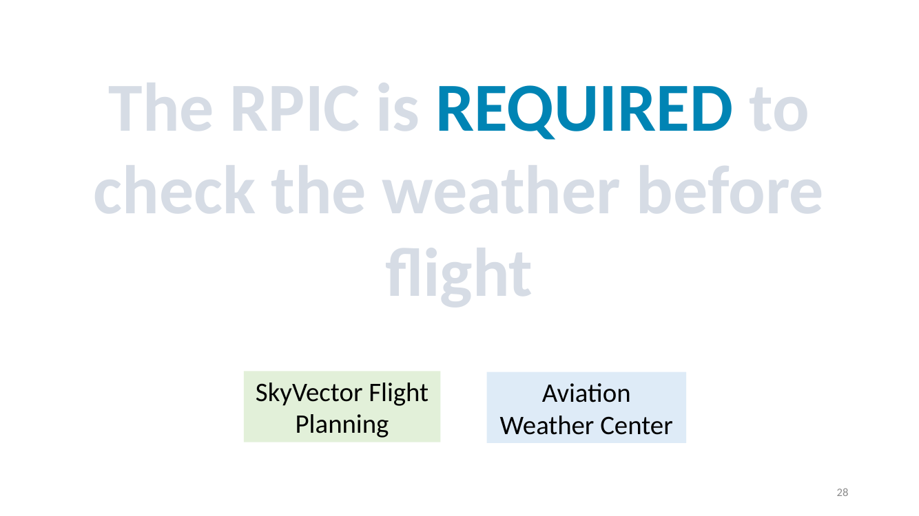
The RPIC is REQUIRED to check the weather before flight (14 CFR 107.49).
- Tools named on the slide:
- SkyVector (skyvector.com) — free flight-planning chart with overlay of TFRs, METARs, SIGMETs, and sectional imagery.
- Aviation Weather Center (aviationweather.gov) — the official NWS hub for METAR, TAF, PIREP, SIGMET, radar, satellite, icing/turbulence.
- Other widely used tools: LAANC apps (Aloft, Airmap), 1800wxbrief.com, the FAA B4UFLY app.
Convective SIGMETs — severe thunderstorm alerts
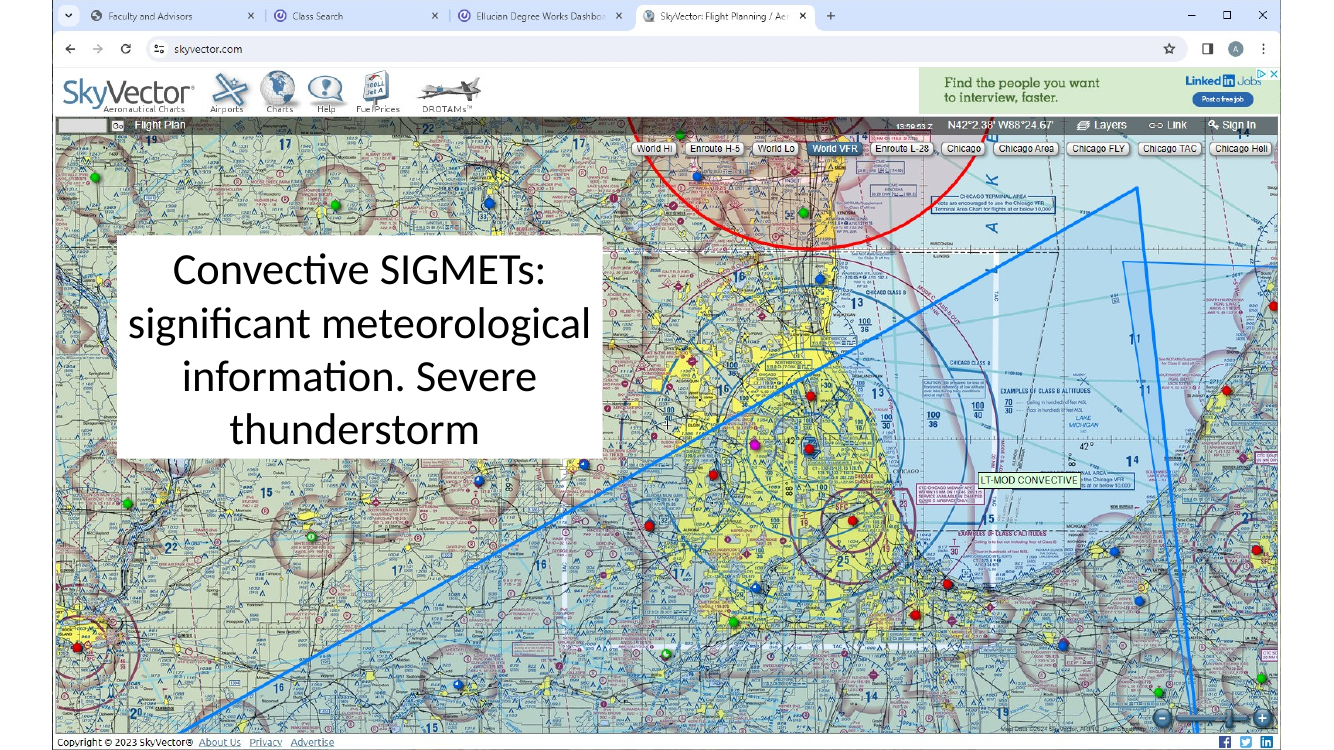
Convective SIGMET — “Significant Meteorological” advisory.
- Alerts for severe thunderstorms, lines of thunderstorms, embedded thunderstorms, hail ≥ 3/4 inch, tornadoes.
- Issued by the Aviation Weather Center for the CONUS.
- Valid for 2 hours typically.
- If a convective SIGMET is active in your area, do not fly. Gust fronts, lightning, and heavy rain will destroy a sUAS.
METAR — meteorological aerodrome report
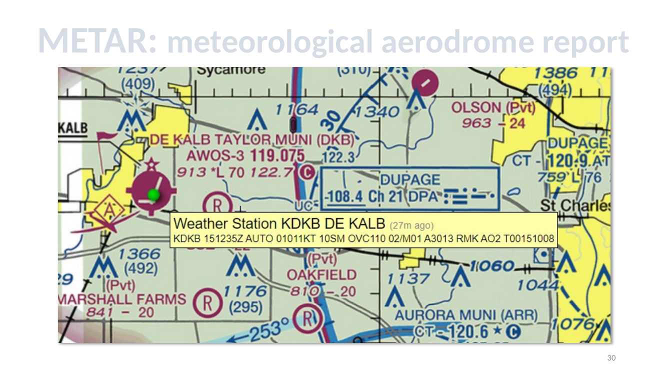
METAR — Meteorological Aerodrome Report. The standardized short-form hourly weather observation issued at thousands of airports worldwide.
- Typical METAR example:
KDKB 151235Z AUTO 01011KT 10SM OVC110 02/M01 A3013 RMK AO2 - Order of fields: station, date/time, modifier, wind, visibility, weather, sky, temperature/dewpoint, altimeter, remarks.
Decoding a METAR — station, date/time, automation
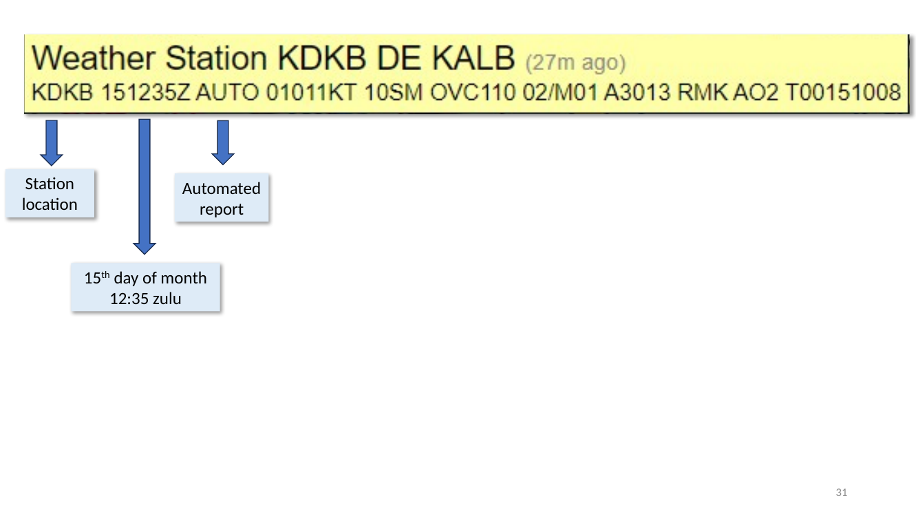
Decoding a METAR header.
- KDKB — station identifier (DeKalb, IL). The
Kprefix = CONUS airport. - 151235Z — day 15, 12:35 UTC (Zulu time). Always UTC, never local.
- AUTO — report generated by automated equipment (ASOS/AWOS), not a human observer.
- Age “(27m ago)” on the slide just reflects how stale the report is at the moment of reading.
Decoding a METAR — wind, visibility, sky
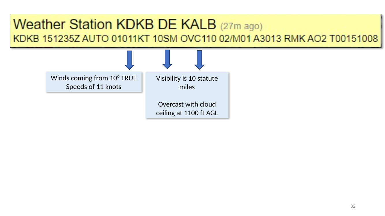
Decoding wind, visibility, and sky in a METAR.
- Wind —
01011KT→ wind is FROM 010° true at 11 knots. Note wind direction in METARs is true, but spoken ATIS/ATC wind is magnetic. - Visibility —
10SM→ 10 statute miles (shown “P6SM” = greater than 6 SM is also common). Part 107 minimum is 3 SM. - Sky —
OVC110→ overcast cloud deck with ceiling at 11 000 ft AGL (add two zeros). Other sky codes: CLR (clear below 12 000), FEW, SCT (scattered), BKN (broken), VV (vertical visibility / obscured).
Cloud-base estimation from temperature and dewpoint
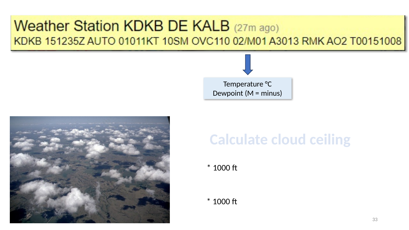
Cloud-base estimation from temperature and dewpoint.
- METAR
02/M01→ +2 °C / −1 °C (“M” = minus). Spread = 3 °C. - Rule of thumb:
cloud base (ft AGL) ≈ (T − Td)°C × 400. - For this example: 3 °C × 400 ≈ 1 200 ft AGL estimated cloud base.
- The slide’s “* 1 000 ft” annotations refer to applying the formula for each cloud layer found in the observation.
Worked example — can you fly? (Part 107 cloud clearance)
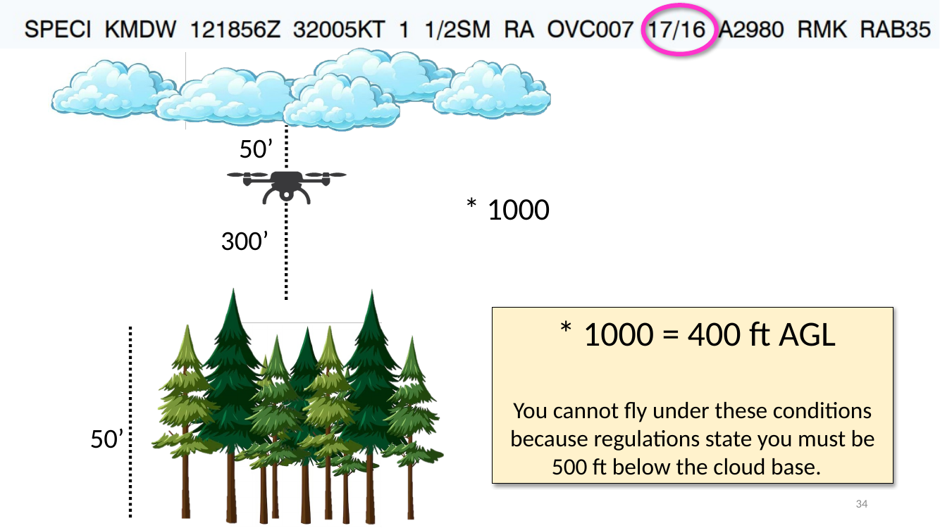
Worked example — can you fly?
- METAR:
SPECI KMDW 121856Z 32005KT 1 1/2SM RA OVC007 17/16 A2980 RMK RAB35 - Temperature / dewpoint: 17 / 16 °C → spread 1 °C.
- Estimated cloud base:
1 × 400 = 400 ft AGL. - Part 107 rule: must stay 500 ft below clouds and 2 000 ft horizontally from clouds.
- With a 400 ft cloud base, there is no altitude below the cloud that satisfies the 500 ft rule — even ground-level is too close vertically (you’d need the cloud to be above 500 AGL to fly at the surface).
- Also note: visibility
1 1/2SMis below the Part 107 minimum of 3 SM, andRA(rain) is present — additional reasons not to fly.
Deck: 2026_Weather_SectionalChartsV2.pptx — 34 slides.
Download original
·
Edit our reproduction